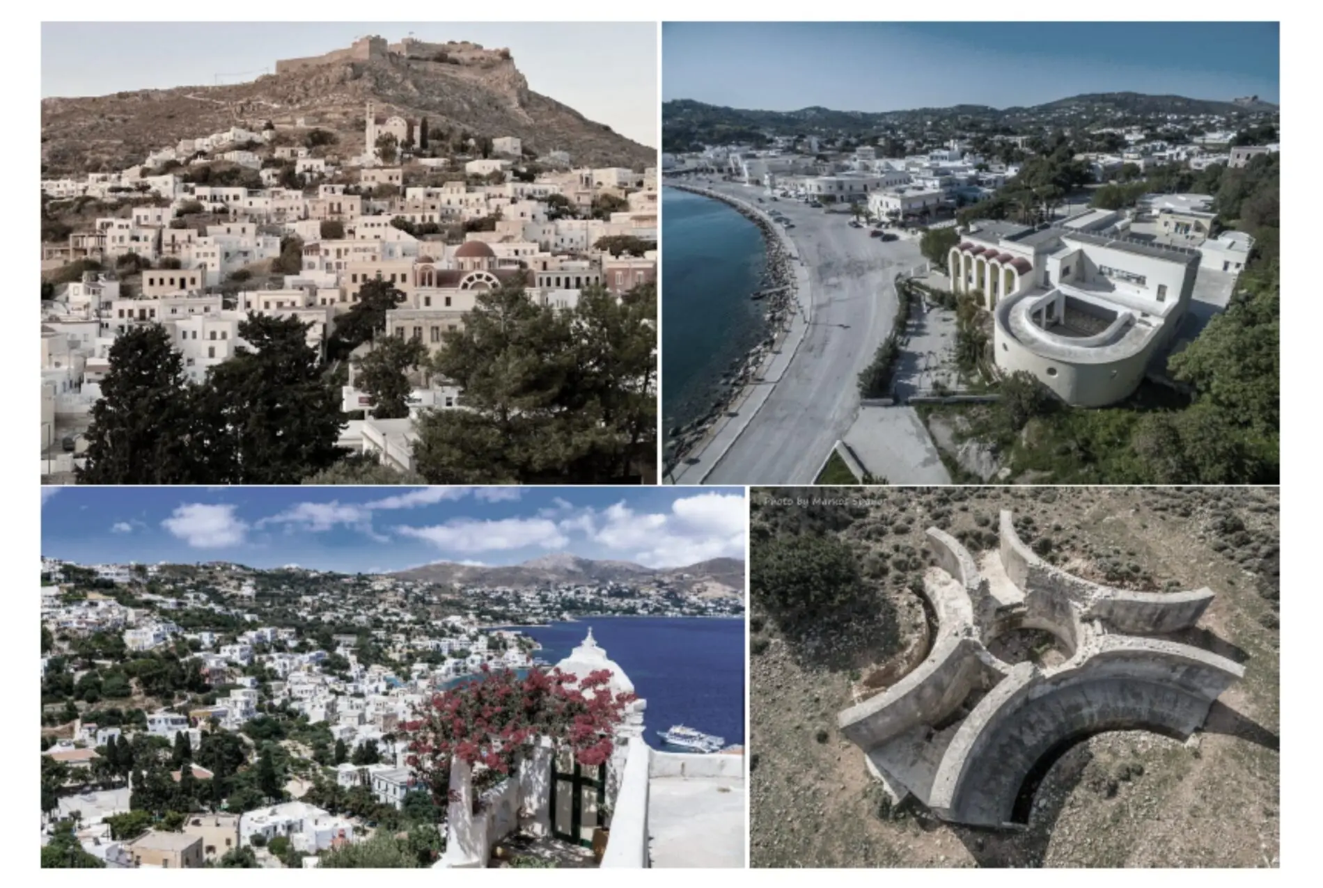
The presentation delivered on 3 February 2026 on the Local Spatial Plan (TPS) for Leros follows a clear underlying logic: to bring order to building activity and land use through zoning, clearly defined settlement boundaries and special protection areas. The study identifies Scenario 2 (moderate intervention) as the preferred option.
Put simply, what the Ministry’s planning team is proposing is a stricter framework for building outside the plan, particularly in the island’s interior, including a doubling of the minimum plot-size requirement (for example, 8,000 sq m for a dwelling of up to 120 sq m), alongside rules that vary by zone. This is expected to drastically limit scattered housing development outside settlements, effectively encouraging (and, in practice, compelling) new housing to be concentrated within defined and organised settlement areas (since finding a compliant plot of 8,000 sq m will be difficult). In fact, the presentation itself (Scenario 1) describes as negative the intensification of unplanned building and the expansion of informal clusters around “high-visit” settlements.
Once the Local Spatial Plan is completed, it is intended to be formally adopted and to shape land uses and spatial development for decades to come, setting rules that affect housing, tourism, agricultural land, coastlines, infrastructure and productive (economic) activities.
What they propose, in 10 points
1) New settlement boundaries
The plan proposes the re-approval and redefinition of the boundaries of settlements that already have defined limits, using the latest criteria, in order to provide legal clarity and to assess where urban planning measures and/or extensions are genuinely needed.
2) Assessment of boundary designation for small islands/islets administratively linked to Leros
The presentation refers to an assessment for defining boundaries in Levitha, Kinara and Farmakonisi, applying the same criteria.
3) Protection rules for Natura, aligned with other studies
For Natura 2000 areas, the presentation makes clear that cooperation with the Ministry of Environment and Energy (YPEN) will be required, along with further specification through Special Environmental Studies and Presidential Decrees.
4) “High-value agricultural land”: priority for production, not residential/tourism pressure
A zone is proposed in which certain land uses are allowed under a defined framework, but not housing, while restrictions are also introduced on tourist accommodation and unrelated processing/manufacturing activities.
5) Coastlines and watercourses: a protection buffer zone
A protection buffer of 25 metres on either side is proposed, with particular emphasis on vulnerability to erosion and inundation due to climate-related impacts.
6) Landscape and landmark zones under strict protection
In particular, for the landscape in the Agia Marina – Merovigli area, a zone is proposed where construction is not permitted, in order to preserve the character and visual integrity of the landscape.
7) A “handbrake” on outside-the-plan development through zoning (not one rule for all)
Land outside the plan is divided into land-use control areas with different rules. In some zones, stricter limits are proposed (for example, a minimum plot size of 8,000 sq m and a dwelling-size cap of 120 sq m).
8) The peri-urban zone around Agia Marina: stricter terms
For the peri-urban zone around Agia Marina, the plan proposes, among other measures, a ban on tourist facilities and a higher minimum plot size (reference is made to 6,000 sq m for a dwelling of up to 120 sq m).
9) Zones for productive activities (low/medium nuisance)
There is reference to the investigation and/or designation of areas for low- and medium-nuisance productive activities, with 200-metre setbacks from settlement boundaries (indicatively west of Kamara, with additional references to zones around Lakki and Temenia).
10) A “package” of directions for infrastructure and functionality
The presentation includes directions for the restoration of old landfill sites/overall waste management, the strengthening of water infrastructure, road safety measures, and port/tourism infrastructure (including references to marinas, for example at Panteli).
What this would mean in practice for residents if Scenario 2 is implemented
-
If you own property outside the plan, your development options would be more limited than under the current framework and would depend far more on which zone the property falls into (not simply on the fact that it is “outside”).
-
If you own agricultural land in the “high-value agricultural land” zone, the logic is to protect it as productive land (with restrictions on housing and tourism-related uses).
-
If your property lies near the coast, a watercourse or within a landscape protection zone, additional safeguards and restrictions would apply.
The problems began with the public consultation
Both in the Municipal Council and in views expressed during the public consultation, reference was made to limited public information and the very short timeframe available for submitting comments and objections. The presentation refers to stages of public information and the recording of views; however, in practice, citizen participation was inadequate.
What should have happened, but did not, was meaningful, proactive public information provided under the responsibility of the competent Ministry, so that residents could clearly and in good time see:
-
which zone their property belongs to,
-
what is permitted and what is prohibited,
-
the justification for the boundaries, and
-
what transitional provisions apply to existing rights.
These points were not presented in a simple, understandable way, with the result that the consultation became a largely formal process, giving the impression that it took place merely “so the matter could be closed quickly”.
Mayor of Leros: “Any increase in the minimum plot size is a casus belli”
During his remarks in the presence of the study team, Leros Mayor Timotheos Kottakis reportedly stated that any increase in the minimum plot-size requirement amounts to a “casus belli”, adding, among other things:
“It cannot be the case that across Greece, including Crete, development is permitted on 4.000 sq m, while on Leros 8 are required. That way, building plots will be turned into fields.”
The main proposals/objections raised during the public consultation
Almost all of the residents who submitted proposals, objections or comments during the time-limited consultation agreed that Leros should follow what applies across the rest of the country: a minimum plot size of 4,000 sq m and a dwelling-size cap of 200 sq m in areas outside settlements.
Particular emphasis was placed on:
-
insufficient public information for residents and local bodies on the part of the Ministry, resulting in limited participation, given that citizens effectively had only around ten days to become informed and submit objections/comments;
-
the particularly conservative population-growth projection for Leros (e.g., 2030/2040). The issue is not whether the numbers are “correct” in the abstract, but that they underpin the assessment of housing and planning needs, water supply and sewerage, traffic/parking, and tourism carrying capacity. If the assumption is “modest growth”, the plan tends to produce a “modest solution”. Yet if the reality (tourism pressure, migration-related factors, short-term lets, seasonal workers) is more intense, the entire study risks being undermined because the wrong baseline data will have been used.
Additional points raised included:
-
the incorporation into Leros’ spatial plan of the overwintering/lay-up areas at Partheni, along with lifting/berthing port installations, and the proposal to establish an Organised Land and Sea Service Zone for leisure craft in the Bay of Partheni, as well as the spatial organisation of existing vessel-service businesses on both sides of Leros Airport;
-
PED: the siting of industrial/craft zones in Kamara, Lakki and Temenia; permitting low-nuisance professional workshops within settlements; and increasing the required distance from settlement boundaries from 200 m to 500 m;
-
PEX 4: the peri-urban zone of Agia Marina (Panteli, Platanos, Agia Marina);
-
various private requests involving boundary corrections;
-
a request to reduce the designated wetland in the Kokkali – Germanou area;
-
distances from cemeteries;
-
the expansion of the settlement of Partheni;
-
the coastal settlements;
-
coastlines and watercourses (a request that building terms in coastal areas should not be altered without scientifically documented justification);
-
the road network;
-
PEP 1: Natura 2000 areas;
-
PEP 6: landscape protection;
-
PEX 5: special uses, including the State Psychiatric Hospital;
-
water scarcity and the water balance;
-
the Sustainable Urban Mobility Plan;
-
the energy transition and the siting of renewables;
-
aquaculture.
The proposals submitted by the Municipality of Leros
The Municipal Council’s observations relate to the proposed Alternative Scenario 2 (Moderate Intervention) and are summarised as follows:
-
PEP-3 (Coastlines and Watercourses): for watercourses that are not delineated and formally designated, it is requested that the protection buffer be 20 metres (as stated) rather than 25 metres.
-
PEX-4 (Agia Marina restrictive/peri-urban zone): the minimum plot size should not be increased to 6 stremmata and should remain at 4,000 sq m. In addition, a dwelling-size limit of 150 sq m is proposed instead of 120 sq m.
-
PEX-6 (Interior): similarly, the minimum plot size should not be increased to 8,000 sq m and should remain at 4,000 sq m, with a proposed dwelling size of 150 sq m instead of 120 sq m.
-
PED (Low/medium nuisance productive activity areas): beyond the proposed location west of the settlement of Kamara, additional locations are proposed east of Kamara and at Partheni (in line with the existing General Urban Plan), as well as in the area of the former landfill site near the existing quarry zone.
-
Xirokampos (former inactive quarry): within a 100-metre radius of the quarry, it is proposed that land uses related to sport and culture be designated, as part of improving the area.
-
First-time settlement boundary designation: beyond the assessment for Levitha, Kinara and Farmakonisi, it is requested that the islet of Archangelos also be added.
-
Large-scale photovoltaic park: south-west of Xirokampos, outside settlements and within grazing land (PEX 3.b), it is proposed that there be the possibility of developing a large photovoltaic park on a south-facing slope.
Σχόλια αναγνωστών
Τα σχόλια δημοσιεύονται κατόπιν έγκρισης.